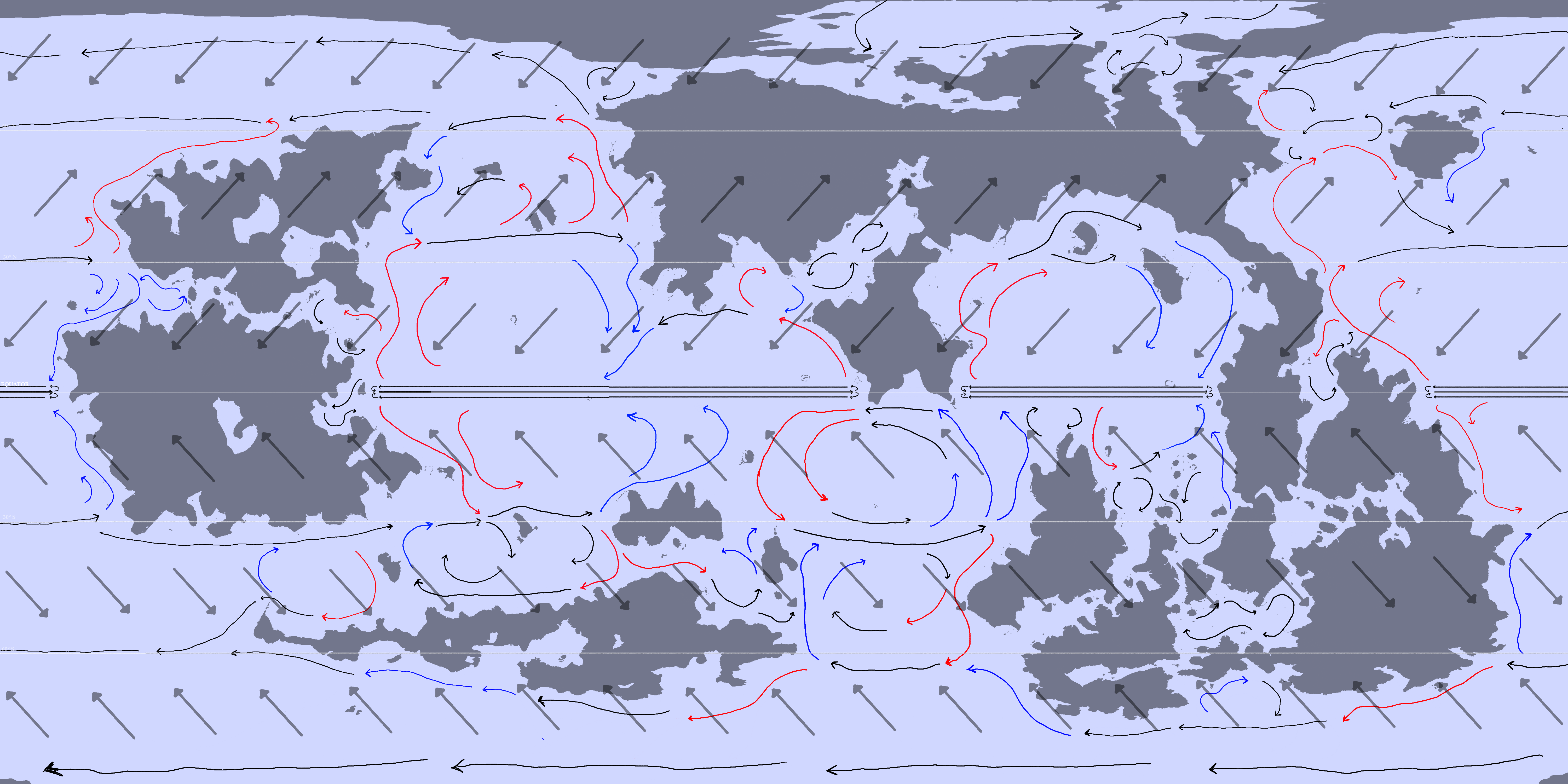
Ocean currents and Winds
Since this is taking a while, I'll be posting the analysis in multiple parts as I get each of them ready.
This map only applies to a planet very similar to earth in rotation speed, direction, and size.
First, Wind and ocean gyres.
I added arrow within the big arrows to show the polar easterlies, westerlies, and trade winds I had taken this into account in the previous analysis' but I didnt show it in the images.
I've once again left out neutral ocean currents. I can add them in for a full ocean current map if anyone wants one but where the neutral currents lay should be relatively simple to deduce.
Another addition is the intertropical convergence zone (equator, red), subtropical ridges (north and south of the equator, blue), and polar fronts (far north and south, red).
ITCZ and the polar fronts create a belt of low air pressure that goes around the entire globe. Conversely, the subtropical ridges create belts of high air pressure. Furthermore, the belts each divide the planet into rough climate zones. Areas between the ITCZ and subtropical ridges are hot, areas between subtropical ridges and the polar front are temperate, and areas beyond the polar fronts are cold. This gives the general foundation for temperatures, but for a better climate approximation, the ocean currents have to be taken into account, which I will do in my 3rd post on this.
For seafaring, the ITCZ and the subtropical ridges create areas where the winds are unpredictable and often stagnant, meaning that ships relying on sails for locomotion may risk getting stuck in the zone for days or even weeks. Unprepared sailors would risk starvation, scurvy, or death.
I'm sure I'm forgetting about some points but if there are questions I can try to come up with an answer. Next post will be on weather phenomena and rainfall regions

.
this is an old map.
